After purchasing rural property, perhaps the most important thing is to know your boundaries. This is vitally important because you don’t want to to short yourself and you don’t want to encroach on your neighbor. In many places, there are stiff penalties for cutting down your neighbor’s trees, building privies and other structures too close to boundaries and other boundary violations. I am a respecter of boundary lines. I don’t go on my neighbor’s property without permission. I am more than willing to share my property and open my property to visitation by neighbors and others but I want them to ask, I want to know when they are visiting and what they are doing. One of the early problems I had at The Land was gaining control of access. The property had been vacant and unoccupied so long that people from the area and beyond had grown used to using it when and how they wanted. With one notable exception, a group of out of town hunters, regaining control
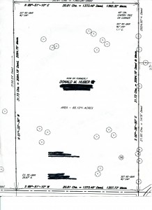
The survey of my property
of access was easy and free of unpleasantness.
Finding your boundary lines is generally simple task that starts with looking at the survey materials that you received at purchase. Usually, buying rural property does not involve an actual survey because of the costs of surveying a large tract of land. However, the survey materials you receive at purchase will have some clues; the dimensions of your property, length and width, the compass heading of the property lines, 42 degrees north and 132 degrees east, and some include identifying features, large rock in south west corner.
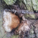
A tree with embedded wire can be a sign of a property line.
Using these clues and others like old fence posts, a neighbor’s field, roads or barbed wire embedded in trees, you will be able to mark your lines. I would advise being conservative and when in doubt visit your neighbor and come to an understanding about where the line is.
I was fairly fortunate that three of my four boundaries were relatively easy to find. The east side was bounded by a neighbor’s field, the west side by a planted pine grove, and the south side by the county road. The east and west side also had some historic markers like old
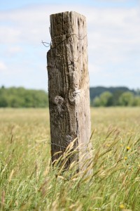
Old Fence Post. Look for man made shapes and nails.
fence posts and, in few places, barbed wire was embedded in trees that grew along the property line. The north side was a problem, few markers remained but I was fortunate to find a large Black Cherry tree in the north east corner that was mentioned in the survey description and had barbed wire embedded in the east and north sides of the trunk. Starting at this tree and using a compass, I was able to mark the north line.
I have to add a small story here that may prove instructive. My neighbor to the north, at the time, I have a new neighbor now, was also the person from whom I bought the property. He owned several parcels in the area adjacent to one another. When I marked the boundary line in the north, he went ballistic thinking I was, as he said “stealing his land”. I tried to work this out with him by reasoning and compromise but he insisted the boundary was well into what I believed was now my property. In his defense, there was a fence line that ran east west in the area he believed was the boundary line ran. It is possible, that over his years of ownership, he became accustomed to thinking of this as the boundary. The problem for me was that it was 250 feet south of where I believed the line should be and also well south of the Black Cherry mentioned in the survey. The disputed area was about
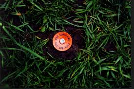
Surveyor’s stake, usually placed at corners.
8 acres, over 10% of the total amount of land I believed I was buying. After much thought and attempts at reconciliation, I decided to have a survey done. It was expensive, but I regained my 8 acres and now had “official” stakes and blazes clearly marking my boundaries and ending the argument. I have maintained these over the years and can still locate all the stakes. The cost of the survey raised the cost of my property by about $75.00 per acre, but 20 years later I don’t regret doing it to protect my rights.
A few final thoughts about marking your boundary lines;
- Check with your local community about proper boundary line markers and posting. This can vary by state and county.
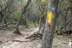
Blazes are a generally accepted way of marking boundaries and trails.
- Before you cut blazes into trees or do other permanent marking, talk to you neighbor and have a general agreement about where the line is. Usually, they will know and be helpful.
- When setting stakes, making blazes or hanging posted signs, if you are not a surveyor, stay inside your side of the line by a few feet. In my opinion, this is just being polite.
- Having done the work of talking to neighbors, finding and marking your boundaries, maintain them by repainting ever few years and renewing old, worn or damaged posted signs.
Good boundaries make good neighbors. Do it early, do it right and maintain it.
